9
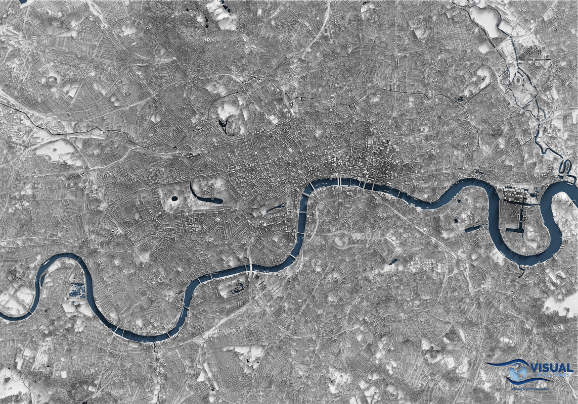
A detailed shaded relief map of London rendered from Lidar data [work by u/visualgeomatics on reddit]
(i.postimg.cc)
Source: England National Lidar Program
Tools: Blender, QGIS, Global Mapper, Photoshop
They mosaiced a lidar tile dataset into a surface model and cast light on it to create a highly detailed image that looks 3d.