everydayhiker

joined 3 weeks ago
[–] everydayhiker@lemmy.world 2 points 10 hours ago

Damn, that is wild. Agree on the cats, they worry more than anything and I’ve rarely ever even seen any. I had wondered if many people went out that way as a backpacking trip, but I’d say you filled it in really well. Thanks!

[–] everydayhiker@lemmy.world 1 points 16 hours ago

Apparently I don’t know the right string to ping you on the other thread, but its up now. I think the final waterfall/rapid is the one you referred to, at the boundary area of the wilderness.

[–] everydayhiker@lemmy.world 1 points 16 hours ago* (last edited 16 hours ago) (2 children)

u/ikidd I believe the final waterfall pictured is the one you mentioned as having the campground. Its right by the boundary of the wilderness area. Definitely not the same as what I originally thought.


Moderate, 1,322 ft gain 9.5 mi Out and Back

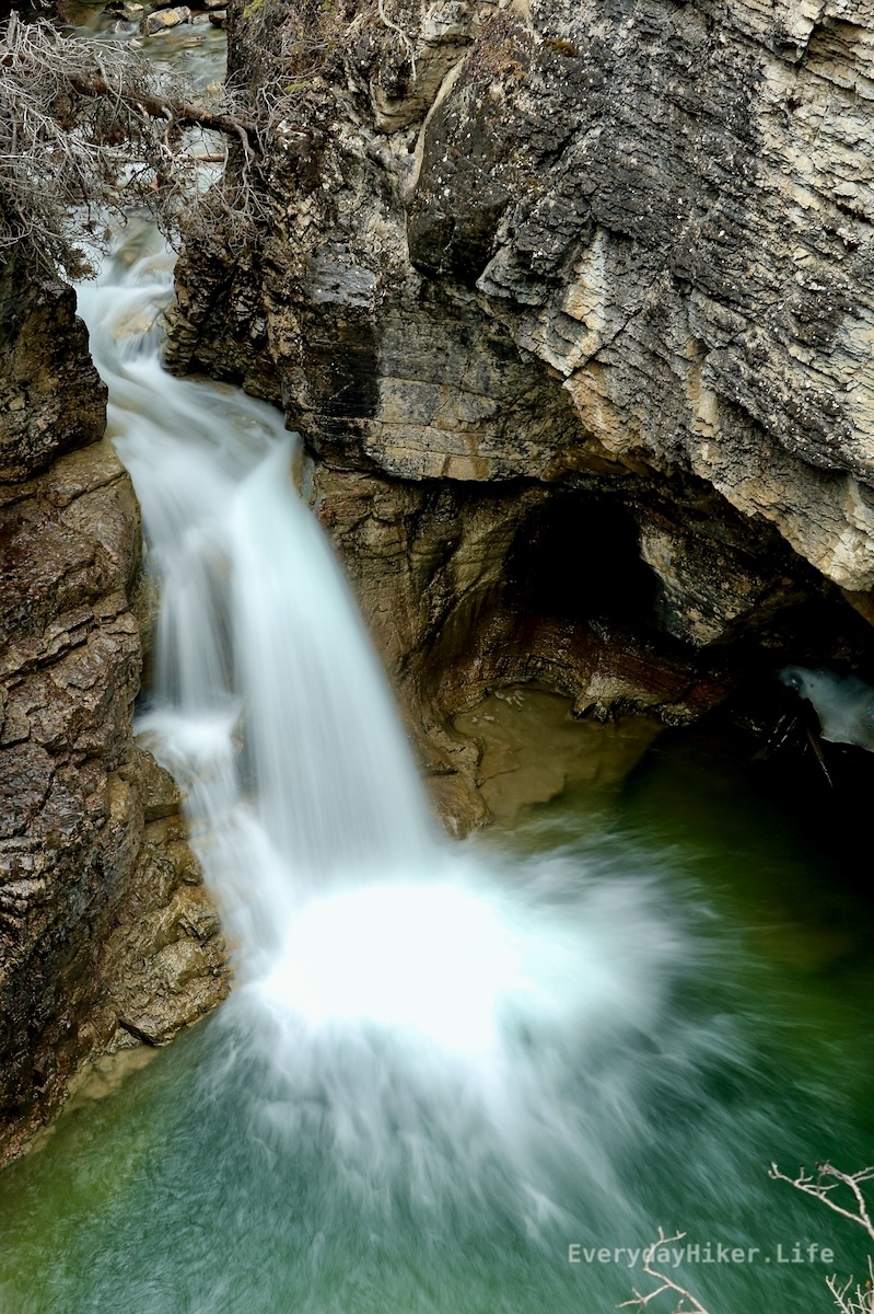
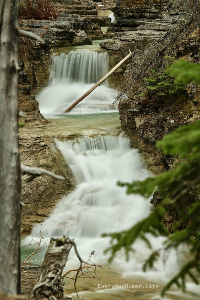
Extending beyond Siffleur falls for another 2.3 mi to the edge of the Siffleur Wilderness area, this trail add-on increases the difficulty and the trail degrades as you get closer to the wilderness area. More views of the various rapids and falls as well as a closer look at Elbe Peak. Rope section at the end to climb a degraded hill, but not too difficult. I believe another tenth of a mile from where I turned around is a small campsite as mentioned in yesterday’s comments.

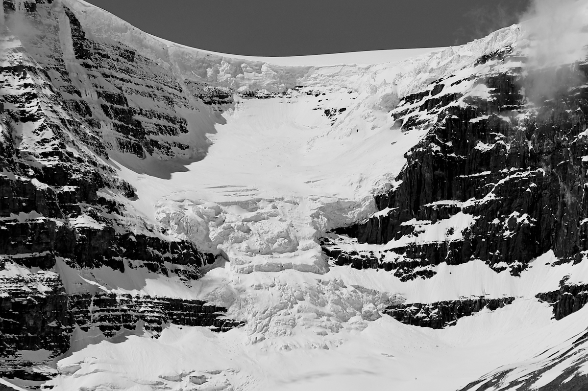
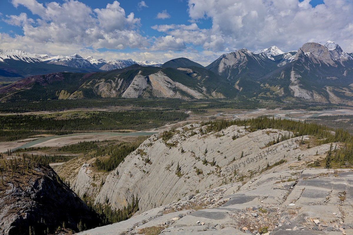
Elbe peak stabs its way upward while the Siffleur river flows through the canyon below.

The steep ridgeline of Elbe peak.

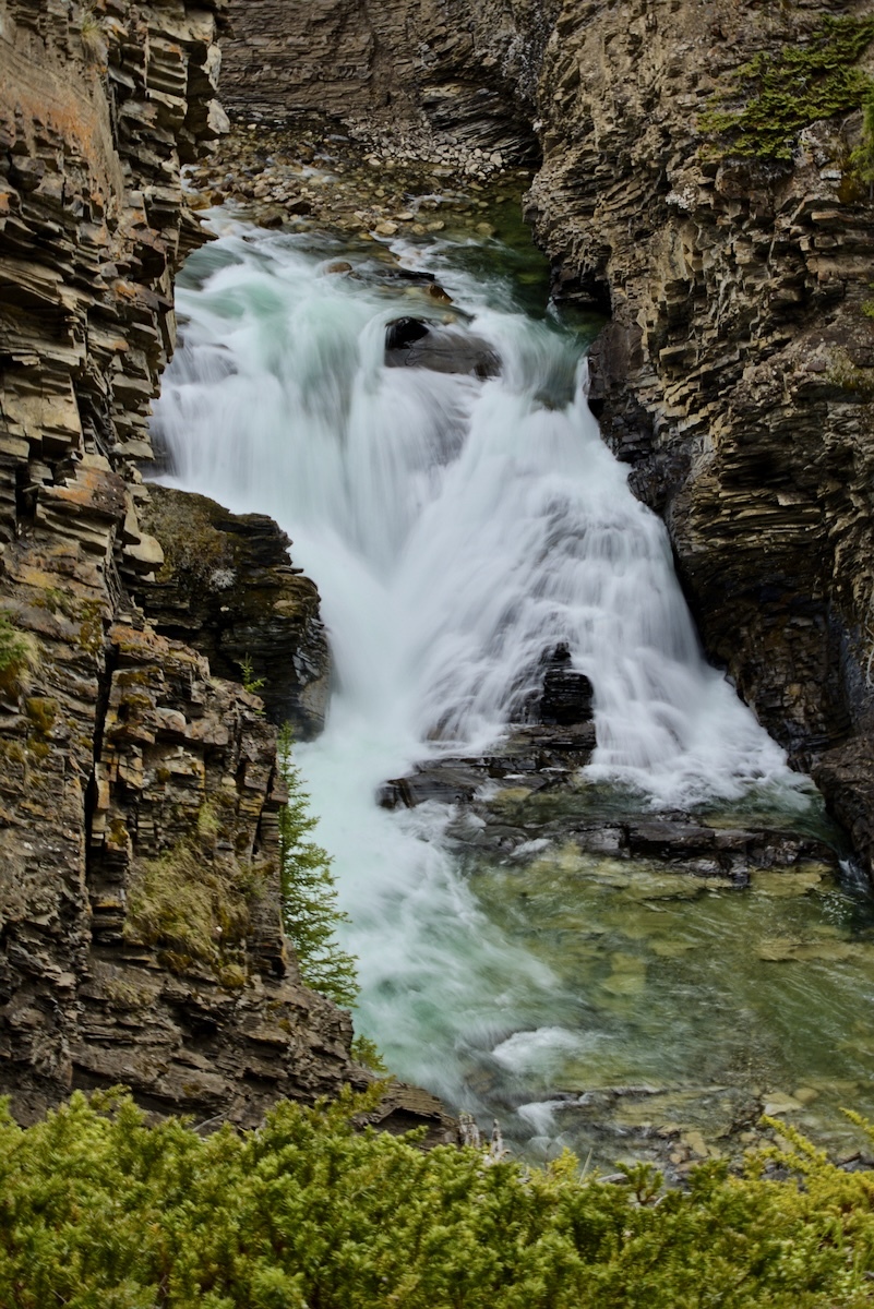
One of the better waterfalls beyond the main Siffleur falls, this is at the edge of the wilderness area and has another rapid out of frame below.

[–] everydayhiker@lemmy.world 1 points 1 day ago* (last edited 1 day ago) (3 children)

Yeah, I continued on to just past the hill with the ropes to get up and then turned around after seeing that viewpoint of the long rapid/falls. Seems like it gets pretty wild from there on. Tomorrow I’ll post a group of photos from that section beyond the main falls. Although I couldn’t get a photo I like, I think my favorite section was half a mile or less beyond the main falls where that huge wedge rock is getting cut by the river before you start to climb again. I believe that is where the camping may also be. IIRC one of the falls I’ll post tomorrow is just upstream of it. That and the bridge, I love pedestrian bridges haha.


4.4 miles roundtrip (to falls only) Easy, 475 ft elevation gain

This trail starts by crossing the N Saskatchewan river over a large pedestrian bridge. From there you will continue upstream from where the Siffleur river ends up to the main waterfall area, passing through an expansive grassland and above the canyon carved by the river. Trail may be extended well beyond the falls, I turned it into a 9.4 mile total, which I’ll post some pics for tomorrow. This trail probably doesn’t need splitting, but I’m gonna do it anyways haha.

Siffleur falls roars its way down into the canyon.

A fraction of the overall falls can be seen from this upper viewpoint. The majority is diverted behind the rock in frame.

Looking along the deep trench walls at the end of the canyon as the Siffleur river continues on.


Still to the east of Icefields Parkway the Cline river feeds into the N. Saskatchewan river. You’ll hike above the canyons carved over time by the Cline for 2 miles before heading back while seeing 3 or 4 waterfalls (still frozen at time of hike) and have sweeping views of Sentinel mountain. On the return, you can come back the way you came (recommended) or return via a horse trail that loses the majority of the view. Hiked 5/21

The Cline river flows away from Sentinel Mountain before cutting its way into the canyon below.

The Cline river cut through this ridge over time, creating the entrance to a slot canyon. The stream quickly redirects itself as it hammers into the cliff wall.

The still frozen waterfall shows some life as a small trickle finds its way out the lower section. There were 3 or 4 still frozen falls along the trail. Black and white.

The Cline river exits a slot canyon with Sentinel mountain off in the distance.

[–] everydayhiker@lemmy.world 1 points 3 days ago

Thanks, I appreciate it! Yeah, since it’s mostly all trail photos that I take, I enjoy placing people at a distance for scale if I’m trying to include the route. Today’s post has a pretty good one as well that I liked.


Just east of the Icefields Parkway in Alberta this great trail opposite the beautiful Abraham Lake (N. Saskatchewan River). Gaining 2800 ft to get to the top of Allstones ridge includes a long exposed section of loose rock well worth the effort before heading down to the smaller Allstones lake. There is some amazing camping all along Abraham lake, requires the $30 annual Public Land Use Zone permit (what a great bargain). Hiked 5/20/25

The glacial waters of Abraham lake seen below the rocky peak of Allstones ridge. Snowy Kista peak is off in the distance.

Downhill from the summit of Allstones ridge, three hikers may be seen talking (about 1/4 mi away). Allstones lake is partially frozen below with Infinite Stones peak looming over it.

Looking out from the hillside, a rain/snow shower falls on Abraham lake below. Kista peak and Mt Michener can be seen in the background. This is the slope for the majority f the loose rock section, it gets steeper but with more defined footing at the top.

Abraham mountain and Allstones peak on the other side of a forested valley. Black and White.


Hiking along the glacial till in the large bowl of the Athabasca glacier leaves one filled with awe. This short route takes you to a nice viewpoint in the location of the glacier in 1996 before turning back around or advancing on another trail. I combined this trail with a small section of the Boundary trail that took me to that super sketchy crevasse. Also pictured with the other trail photos is a collection of the markers for where the glacier was located in 1996, 1948, and 1844.

Crumbling snowpack spans the outflow of the Athabasca Glacier, which may be seen in the background. Small from distance, the vehicles that drive up to the glacier may also be seen along with their tracks.

Black and white picture of Athabasca glacier.

Gaze up at Mt Athabasca before crossing the bridge early on the trail.

Marker displaying the location of the Athabasca Glacier in 2006, with the glacier seen over a mile behind it. Black and white.

Another example of the retreat of the Athabasca glacier. The people are at the location of the 2006 marker.

The Athabasca Glacier is well over two miles away from this marker designating its position back in 1948.

The location of the Athabasca glacier in 1844, the glacier can be seen well off in the distance. This marker is on the far side of the parking area opposite the highway from the glacier.


A short hike made slightly more difficult by the remaining snow in the trail on 5/15, mile long out and back descends from where the parking lot to the falls along a steep ridgeline. Views of bridal veil falls may be seen across the valley, and later in the year a path to them may be accessible.

Panther Falls drops down while the creeksides remain partially snowbound. This fall may create a good snowcone structure in winter based on some of the snow chunks I saw laying around.

The trail passes under a fallen log amid some boulders while bridal veil falls may be seen through a gap in the trees across the valley.

Same view of the falls as the main image, but this time with me being blinded by the blazing sun in the foregound.


One of the many great waterfalls with an easy hike along the Icefields parkway in Jasper NP, this 2.6 mile roundtrip rises a mere 450 ft along Beauty creek. Multiple falls are passed along this route that is highly worth the minimal effort. Hiked 5/14

Another waterfall below Stanley falls and the pretty patterns formed from its outflow.

A smaller fall that is upstream from the main Stanley falls.

A front view of one of the long rapids shows how clear the water can be when it is not being disturbed by flow.


Another short but steep hike in eastern Jasper National Park, this hike takes you to a valley nestled under Roche Miette before you get to the bald up top. Much less intimidating than the wall on Morro Peak, but just as physical. One ladder section is easily climbed along the way and you may see some mountain goats while you’re up there! Hopefully he doesn’t see you eat it on the muddy slope like he did for me! At the trailhead is a great spot to watch Bighorn as well.

The ladder chained to the rock face leads to a slippery section made easier by the heavy duty chains running the length of it.

Looking back towards the Athabasca river valley below. The trail is in the lower valley and not on top of the ridgeline.

A look back towards the highway shows how quickly this trail rises before entering the canyon. The Athabasca river valley sprawls below.

[–] everydayhiker@lemmy.world 1 points 1 week ago

Yeah, as posted above, its in the Canadian Rockies.


Covering a lot of elevation in a short span, this #hike has you wrap around the sheer wall face before ascending to the large bald above the Athabasca river valley. While moderate, the 2k ft gained in less than 2 miles (3.4 total) leads to some steep sections. Hiked 5/11/25

The view to the west towards Jasper from the viewpoint on top of Morro peak.

A nice viewpoint if you can stand it as you wrap back down along the cliff face. While steep and loose, the trail here is four feet wide so it's easy to look away from the open drop below.

Looking up at Morro peak. The trail goes up the left side until around the tree line before crossing to the rught and up and then wrapping up the right edge of the rock wall.


Starting with a quick bridge crossing onto the small Pyramid Island, this trail returns to the mainland before rising above the town of Jasper to some great overlooks. Bighorn sheep may be seen on this trail as they frequent the area. This area of Jasper gets super busy with limited parking, but you can start it from any of the small lots along the lake.

Rust-specked Pyramid mountain dominates the frame with what remains of its snowpack.

A view of the Athabasca river flowing away and towards the town of Jasper, with mountains of the northern edge of the Icefields Parkway beyond.

A collection of Bighorn rams grazing on the hillside. This area and to the east is filled with Bighorn.


This 6 mile out and back trail will take you past the Sulphur Gates into the , a cool looking geological feature shaped by water, to a waterfall that has carved the rock into an intriguing spiral pattern.

A photo showing the lower and middle sections of Eaton falls as you approach from a distance.

The way the small canyon warps up around the waterfall is hard to convey. Me for scale.

The Sulphur gates, formed as water cut through the ridgeline to merge the rivers below.

Kind of out of the way to get to, I mostly went here as I was stalling for time for snowmelt. The waterfall itself was very cool though.

May miss tomorrow, not sure if I’ll get back to service or not (Kootenai NP).


An extremely popular trail around Edith Lake just east of the town of Jasper, this 3.6 mile loop can be broken into any number of sections along the lake shore. On May 5th, the crowds had yet to arrive in full force. The hike itself its pretty basic, but it’s got great views and a good chance to see various wildlife.

A canoe sitting in front of the reflective Edith Lake.

The turquoise waters of Edith Lake in front of Mt Edith Cavell.

Pyramid Mountain as seen from the northside of Edith Lake.

[–] everydayhiker@lemmy.world 1 points 2 weeks ago

Would love to do the whole thing someday. Super jealous of the 2018 trip you had. Yeah, I’d like to see photos with before/after.

[–] everydayhiker@lemmy.world 1 points 2 weeks ago

Oops, yeah somehow I had it as whitehorn mtn, whitehorse cg, and white falls (which i believe is still correct). Thought that was a bit much. Glad I was wrong.

[–] everydayhiker@lemmy.world 2 points 2 weeks ago

No, it’s something I’ve noticed too as I’m seeing them posted. Think I need to adjust display settings on the monitor because they seem less so on it, and generally just get better at it as well. Thanks for the advice!

[–] everydayhiker@lemmy.world 2 points 2 weeks ago

Yeah, i’m still learning darktable so some of these images may still come out looking a bit odd on the post processing. I’m likely to go back through each of the ones i already uploaded to flickr and reupload better processed ones now that I’m getting a better handle on the software, because there are some that I feel already look much better after a second pass.

As for the over-exposure on these, yeah I got a newer lens over the winter and when I got there I realized I never got any ND filters for it so I was just dealing with the sun. I tried playing with the images but found that I could never find anything that made me happy, and I didn’t think the original image was good enough to dig too deep into it if I’m being honest. The waterfall itself is doing all the heavy lifting on that one haha.

Long story short, the processing should improve over time but I thank you very much for the advice.

[–] everydayhiker@lemmy.world 2 points 2 weeks ago

Thanks! Those are some good photos as well! Yeah, I considered doing green mtn lookout as I was passing through, but ended up not doing it. Think I was more interested in getting a shower in clearwater at that point or something haha, maybe next time. Pretty sure that road to Trophy mtn was still closed at the time but it also sounded like a good one.

[–] everydayhiker@lemmy.world 2 points 2 weeks ago

I’m hoping I can pull that off in two years, definitely on the list. This is my first trip to Canada and absolutely love it so far.

view more: next ›