
TIL there are still some (tiny) Zoroastrian majority pockets in Iran, or anywhere for that matter.
TIL there are still some (tiny) Zoroastrian majority pockets in Iran, or anywhere for that matter.
I should've specified the map has data only for countries in the EU. This is the price you pay for Brexit, alas.
It would be interesting to see the results for some Balkan countries too.
Btw, here's the Dymaxion map projection with Tissot's indicatrix of deformation.
And here's the Peirce quincuncial map projection with Tissot's indicatrix of deformation.
And here's the classic Robinson map projection with Tissot's indicatrix of deformation.
And here's the Waterman butterfly map projection with Tissot's indicatrix of deformation.
And here's the, oh horror, Mercator map projection with Tissot's indicatrix of deformation.
Dymaxion map projection does a pretty good job with this info.
Here's a subregional HDI (income per capita+education+life expectancy) map.
The Mediterranean plus the south of Africa, as well as the Gulf of Guinea stand out the most.
Kind of, yes. Surprisingly not that much. But enough to divert all the local water northward apparently.
What's interesting is that all the other surrounding water flows southward. Burkina Faso even used to be called Upper Volta, because of the largest river there.
The Orient Express - The Water Edition.
Fun fact: a journey by boat from London to Istanbul is possible through the continent, not just around it.


They’re not saving the environment, they’re running a monoculture tree farm
Nope.
https://blog.ecosia.org/everyone-getting-tree-planting-wrong/
https://www.ecosia.org/#our_tree_planting_approach
https://blog.ecosia.org/where-why-how-does-ecosia-plant-trees/
https://ecosia.co/finreportsen
Instead of monocultures, we grow over 500 different native species where they are needed most. Always shoulder-to-shoulder with local communities.

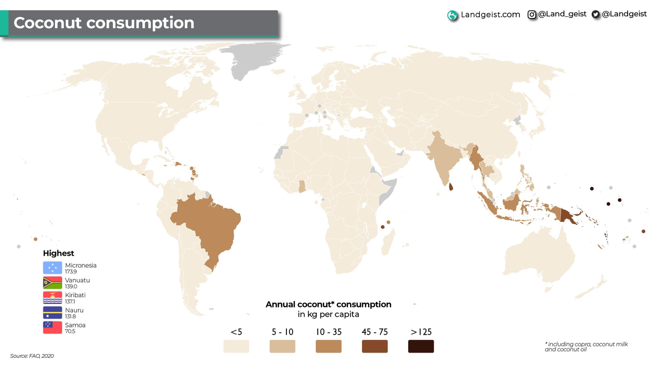
Okay, not coconuts, but kilograms per capita, but one coconut is about 1.4 kg. Close enough
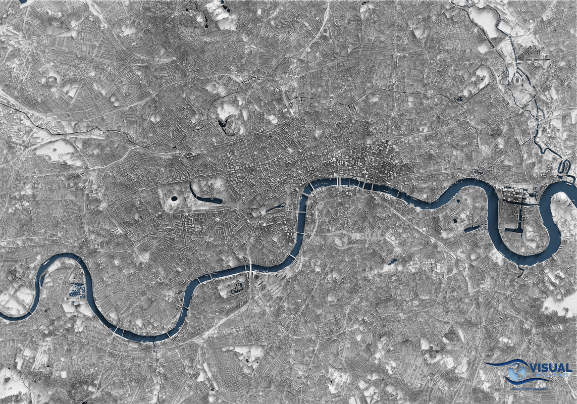
Source: England National Lidar Program
Tools: Blender, QGIS, Global Mapper, Photoshop
They mosaiced a lidar tile dataset into a surface model and cast light on it to create a highly detailed image that looks 3d.


I wasn't expecting that much Old Norse tbh.